Access
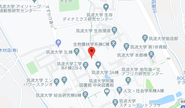
University of Tsukuba Area Map
The "University of Tsukuba Area Map" uses illustrations to quickly show detailed campus maps and how to access various facilities.
Access to the College of Policy and Planning Sciences

By train
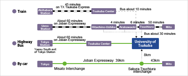
Tsukuba Express (TX)he train ride from Akihabara Station to TX Tsukuba Station on the Tsukuba Express (TX) takes about 45–55 minutes.
From TX Tsukuba Station you can take a Kanto Tetsudo bus, on either the "Tsukuba Daigaku Junkan (closewise/migi-mawari)" route or the "Tsukuba Daigaku Chuo-yuki" route, to the "Daisan Area-mae" bus stop. It takes about 10 minutes. The "Tsukuba Daigaku Junkan (counterclockwise/hidari-mawari)" route also takes you to "Daisan Area-mae", in about 15 minutes.
JR Joban LineIf you take the JR Joban Line, get off the train at Hitachino-Ushiku Station, or Arakawaoki Station, or Tsuchiura Station. (All are about a one-hour ride from Ueno Station, on a regular train). A Kanto Tetsudo bus on the "Tsukuba Daigaku Chuo-yuki" route is available at all stations, and takes you to "Daisan Area-mae" in about 30 minutes.
By highway bus
Highway buses for "Tsukuba Center" or "Tsukuba Daigaku Chuo" stop at the Yaesu South exit of Tokyo Station. The bus ride is 60–90 minutes. (For either bus, you can use one ticket all the way to the last bus stop.) Or take the highway bus to "Tsukuba Center-yuki," transfer to a Kanto Tetsudo bus for "Tsukuba Daigaku Junkan (closewise/migi-mawari)" or "Tsukuba Daigaku Chuo-yuki" at Tsukuba Center, and get off that bus at "Daisan Area-mae" (about 10 minutes). The "Tsukuba Daigaku Junkan (counterclockwise/hidari-mawari)" bus also takes you to "Daisan Area-mae", in about 15 minutes.
By car
On the Joban Expressway, take the Sakura Tsuchiura interchange. Make a left turn towards Tsukuba. Turn right at the Sasagi intersection. Drive north on Prefectural Road 55 (Higashi Oodori). Turn left at the Tsukuba Daigaku Chuo Iriguchi intersection (about 8 km).


